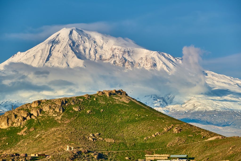

Mt. Ararat
5165 metres high, Ararat is the highest mountain in Turkey. The Turkish name of the mountain is Agi. Ararat is an extinct volcano and its last eruption took place 10000 yers ago.Despite this, its fumes decrease the amount if oxygen in the air. Ararat, like Kilimanjaro, is a free-standing mountain. It is suddenly growing out of the desert. It’s peak consists of two summits, one is 5165 metres high and the other 3900m. The peaks are divided by the pass called Serdebulak, situated at the height of 2600m.
The mountain is located near the boarder with Iran and Armenia on the lands inhabited mainly by Kurds. It is a national mountain of Armenia. The first person who reached its peak, according to the Bible, was Noah, whose Ark landed there after the flood. Till today, many expeditions climb the mountain not to reach its peak but to find the ark. The first person who ascended its summit in the modern times was Frederick Parrot in 1829. The second one was Polish, Jozef Chodzko, who reached the summit in blizzard, through Serdebulak Pass. The best season to climb this mountain is from June to September. We are climbing the shortest and safest way, which is the southern slope. The peak is not difficult technically, however the crampons and ice-axes are indispensable due to the snow. Down the mountain the weather is hot an dry and the temperatures go beyond 30 C. Around the summit, the temperature can fall down to -10 C. In order to get acclimatized before reaching Ararat we’re going to climb Kackar, which is 3990 metres high, and is the highest peak of the Pontine Mountains.
Ararat is located in the military area due to the activity of the Kurds’ guerilla. Climbing this mountain requires a special permit and on the way, climbers are accompanied by soldiers. However, it’s got an advantage – the guarantee of security.
Before setting out it’s advisable to have a vaccination against jaundice and tetanus.It is impossible to take part in the expedition if great heights are harmful to your health.
COSTS:
7200 pln
The price includes; accomodation in mountaineering tents and tourist class hotels, climbing insurance, food (two meals a day, in the mountains third extra meal), the permission to enter the boarder zone, the permission to enter the summit, mules-porters, cook, flight to Turkey (landing in Trazbon, a city close to Ararat, which eliminates transfers inside Turkey that last few days), land transport in Turkey, club’s fee.
The price doesn’t include excess luggage (which rarely appears), visa (10 euros), entrance fees and the costs of sightseeing and voluntary trips. There’s a possibility to hire crampons and ice-axes; 100pln each.
APPLICATIONS:
1.To confirm the reservation, please, pay 1500 pln for the ticket and insurance to the following bank account: stowarzyszenie „ Annapurna klub „ Santander Bank 34 1090 1652 0000 0000 6404 1166 with an annotation „ Ararat- flight and insurance”. Please, inform us about the payment via e-mail or post.
ITINERARY:
We fly to Erzurum or another city near Ararat. Next we take a coach to Olgunlar in the Pontice Mountains, from where we set off to Kackar. After a night we get to Dilber Duzu, 2900m, which is a meadow where we spend the next night in our tents.Next day is intended for climbing Kackar 3990m, the highest mountain in the Pontice Mountains. We spend a next night on Dilber Duzu again. After that we go downhill to Olgunlar, from where we go to Yusufeli, where we can go rafting. Next days are intended for the main point of the expedition – climbing Ararat. To accomplish this aim we go towards the boarder with Iran, to Dogubayazit, where we buy food and get the assisstance of the army. The city is dominated by the powerful mountain which is growing out of the desert. We are in the eastern Turkey, where houses made of mud, dungs and people who are completely different than e.g. in Istanbul, make us realise that in fact we’re in Asia. After the night spent in Dogubayazit we set out for the mountain, first a short ride to the southern slope and finally getting the base camp. Around Ararat, the Kurds still graze their sheep, and, like their ancestors, they lead a nomadic life. On the first day we reach the height of 3000 metres, where we pitch our tents and stay for a night. Next day we reach 3900 metres and spend the next night there. We climb up a typical volcanic path where the stones will slip away from under our feet. From that place, before day, we set off towards the summit, put on our crampons and go uphill on gently sloping snowfields. This shouldn’t take more than 6-8 hours. The view from the summit is really amazing. From the top we go back to the base camp and after a night we go down to Dogubayazit.
The remaining time can be spent on one of the additional options; Cappadocia, Van Lake. We return to Poland after 14 days.
Day by day itinerary
– flight to Erzurum
– travel to Olgunlar
– 2 days of climbing on Kackar (3990m) the highest peak of the Pontine Mountains
– travel to Dogubayazit
– sightseeing: a meteoritic krater, the arks in Ishak Pasha Palace (10$)
– travel to 2200m, climbing up 3000m
– reaching 3900 m
– reaching the summit
– descending to Dogubayazit
– travel and stay at Van Lake or touring Cappadocia
– return to Erzurum
– flight to Poland
NEEDED EQUIPMENT:
– socks (5 pairs of cotton socks, 2-3 pairs of warm socks, 1-2 pairs of anti-sweat socks),
– warm shoes, 1-1,5 size too big with the possibility to attach crampons, the best made of leather or other thermal material, if your feet easily freeze or if you don’t have any other shoes you can take mountaineering boots. If you don’t have them you can take trekking shoes, but they must be warm as there may be snow.
If you take very heavy shoes (e.g. mountaineering boots or leather shoes) it’s worth to take another pair of light trekking shoes.
It’s good to take sandals or trainers
– Polar fleece trousers – polar 100 (1-2 pairs)
– Wind and water-proof trousers
– Trekking gaiters,
– underwear (including anti-sweat vests) and thin cotton underwear
– 2 polar fleece jackets – polar 200 and 1 polar fleece jacket – polar 100
– polar gloves and spare gloves (woolen or polar)
– over-mitts (goretex) or warm skiing gloves
– goretex jacket or a similar one
– hat, scarf or a cap to protect you from the sun
– headlamp and spare batteries
– sunglasses
– thick foam pad or a mattress
– synthetic sleeping bag (1,5 kg) or a down-filled one (0,8 kg) (min. -10 degrees)
– rucksacks; 60- 80 and 30-45 litres,
– shorts, or long, breathable trousers and a shirt (instead of long and short trousers it’s best to take the long ones with detachable trouser legs)
– Sun protection cream, protection factor 25-40, a good French one
– Telescopic sticks (not necessirily)
– vacuum flask,
– mess tin ,
– camping burner (pierceable cylinders C 190, the ones that must be used after being fixed and cannot be dismantled when they contain the gas inside)
– cutlery (knife and spoon),
– arcticles of toilet , toilet paper
– photo camera,
– crampons and ice-axe
– Bic lighter
